

Barelang Bridge, Batam: All Six Bridges, Lengths and Distance from Batam Centre
- KM 0
- 21 km
- B5 · 53
Road distance from Batam Centre ferry terminal (shortest car route, OpenStreetMap data). B = Barelang bridge.
In short: Barelang Bridge is a chain of six bridges linking Batam with Tonton, Nipah, Setokok, Rempang, Galang and Galang Baru islands.
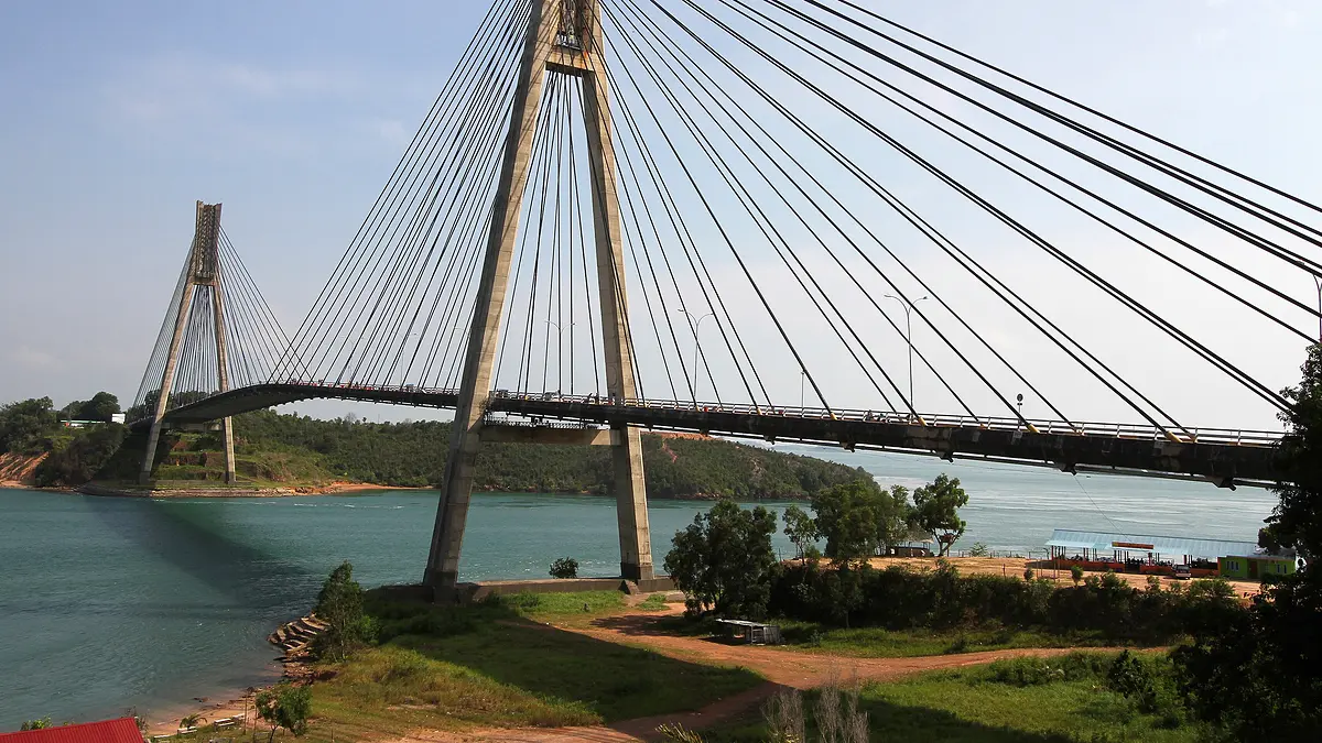
Barelang Bridge is a chain of six bridges that links Batam Island with Tonton, Nipah, Setokok, Rempang, Galang and Galang Baru. Building started in July 1992 and the bridges were inaugurated on 25 January 1998. Bridge 1, Tengku Fisabilillah, is the one most people photograph and call “Barelang Bridge”. It is about 21 km from Batam Centre ferry terminal by road. Each bridge is covered below: official name, type, length and the islands it links.
Who built it and when
- Construction started in July 1992 and finished in January 1998; together the six bridges are about 2 km long. [source, Wikipedia]
- The bridges were inaugurated on 25 January 1998. They were built by the Batam Industrial Development Authority after Presidential Decree No. 28/1992 extended its area to Rempang, Galang and the small islands around them. [source, Wikipedia]
- Some locals call it Jembatan Habibie, after B. J. Habibie, who oversaw the project. The concept design was proposed by Bruce Ramsay of VSL, and Habibie asked for a different structural type for each bridge. [source, Wikipedia]
- Each bridge is named after a ruler of the Riau Sultanate from the 15th to the 18th century. [same source]
Bridge 1: Tengku Fisabilillah (Batam–Tonton)
About 21 km from Batam Centre ferry terminal by road (shortest car route on OpenStreetMap data).
- A cable-stayed bridge with two 118 m pylons and a 350 m main span; at 642 m it is the longest of the six. It links Batam with Tonton island. [source, Wikipedia]
- 21 km Bridge 1 (Barelang Bridge 1)Batam · 1,251 Google reviews 4.6 ★ · Maps · Directions
Bridge 2: Nara Singa (Tonton–Nipah)
- A cantilever bridge, 420 m long with a 160 m main span, linking Tonton with Nipah island. [source, Wikipedia]
Bridge 3: Raja Ali Haji (Nipah–Setokok)
- A girder bridge, 270 m long with a 45 m main span, linking Nipah with Setokok island. [source, Wikipedia]
Bridge 4: Sultan Zainal Abidin (Setokok–Rempang)
- A cantilever bridge, 365 m long with a 145 m main span, linking Setokok with Rempang island. [source, Wikipedia]
Bridge 5: Tuanku Tambusai (Rempang–Galang)
About 53 km from Batam Centre ferry terminal by road. Across it you are on Galang Island, home of the refugee camp and Viovio beach.
- An arch bridge, 385 m long with a 245 m main span, linking Rempang with Galang. The deck was built by incremental launching: assembled on the approach and pushed out over the arch with hydraulic jacks. [source, Wikipedia]
Bridge 6: Raja Kecik (Galang–Galang Baru)
The last bridge, at the southern end of the chain. Halona beach on Galang Baru is in the Bridge 6 area.
- The shortest bridge, 180 m long, linking Galang with Galang Baru island. [source, Wikipedia]
- Halona beach (Halona Beach Resort) is in the Bridge VI area of Galang Baru and opened in 2023. [source, GNFI, Feb 2026]
Frequently asked questions
How many Barelang bridges are there?
Six: Tengku Fisabilillah (1), Nara Singa (2), Raja Ali Haji (3), Sultan Zainal Abidin (4), Tuanku Tambusai (5) and Raja Kecik (6).
What is Barelang Bridge 1 called?
Tengku Fisabilillah Bridge. The 642 m cable-stayed bridge links Batam with Tonton island and is the longest of the six.
When did Barelang Bridge open?
The bridges were inaugurated on 25 January 1998. Construction started in July 1992.
How far is Barelang Bridge from Batam Centre ferry terminal?
About 21 km by road to Bridge 1, on the shortest car route in OpenStreetMap data.
Sources
Related guides
Baca dalam bahasa Indonesia: /barelang/jembatan-barelang/
